|  The
multiple-use Shirley Creek Trail runs approximately 19.5 miles
through a variety of terrains in scenic hardwood forest. It's
shady trails allow hiking, horse riding and mountain biking. The
multiple-use Shirley Creek Trail runs approximately 19.5 miles
through a variety of terrains in scenic hardwood forest. It's
shady trails allow hiking, horse riding and mountain biking.
Horse riders and
mountain bikers are required to have a trail
permit and stay on trails designated for their use. Annual
($35/year) and day-use ($5/day) permits are available from Hoosier
National Forest offices and several local vendors.
This trail is operated by:
US Forest Service
Brownstown Ranger District
811 Constitution Avenue
Bedford, IN 47421
Phone: 812-275-5987
Hoosier National Forest website |
| Shirley
Creek Mountain Biking Trail Info |
| Directions: |
From the intersection of Hwy 50 and Hwy 60, take Hwy 50 West
approx. 0.1 miles and turn left (south) onto CR 980 S Follow
CR 980 S appox. 0.9 miles (as it turns and heads east), then
turn right (south) onto CR 825 W. Continue approx. 3.4 miles
(as the road becomes CR 910 W) to the Y intersection and veer
left onto CR 810N (past Bonds Chapel and the cemetery). Continue
approx. 1.3 miles (as the road becomes CR 740 N) and turn right
(south) onto CR 775 at Hindostan. Continue approx. 1.2 miles
to the Shirley Creek Trailhead sign and turn left (east), then
follow the road to the parking area at the campground.
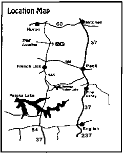
(Check out the maps
above too.) |
| Length: |
Approx.
19.5 miles |
| Trail
Type: |
Mostly
single track |
| Skill
Level: |
Intermediate |
| Trail
Description: |
The
hills and streambeds are challenging, though the rest of the
trails are pretty easy. Loops within loops yield many options.
The trail offers lots of hilly, technical singletrack through
the woods. It's fun, but demanding. |
| YIELDING
THE RIGHT OF WAY |
| Since
you may be sharing the trails with different types of users, please
observe the following trail courtesy: |
| - |
Mountain
bikers yield to horse riders and hikers. (Make your approach known
well in advance.) |
| - |
Hikers
yield to horse riders. |
| - |
Horse
riders: control your horse. |
|
|