|
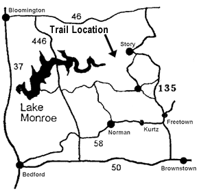
This hiking and horseback riding trail is a cooperative trail that is provided on National Forest land and maintained by the Indiana Trail Riders Association. It ties in to trails in Brown County State Park (managed by the Department of Natural Resources). The trail runs down Miller Ridge between trails on Brown County State Park and trails in the Nebo Ridge area. The entire length of the trail, to the junction where it ties in to other Brown County trails is 7.4 miles, only 2.1 of which are on National Forest land. Horse riders are required to have a trail permit and stay on trails designated for their use. Annual ($35/year) and day-use ($5/day) permits are available from Hoosier National Forest offices and several local vendors. This trail is provided by: |
 |
YIELDING
THE RIGHT OF WAY |
|
| Since you may be sharing the trails with different types of users, please observe the following trail courtesy: | |
- |
Mountain bikers yield to horse riders and hikers. (Make your approach known well in advance.) |
- |
Hikers yield to horse riders. |
- |
Horse riders: control your horse. |
ETIQUETTE AND RULES |
||
|
FACILITIES
AND CAMPING |
||
| No water or restroom facilities are available. Parking is available at the trail head. Hoosier National Forest visitors are welcome to camp at no cost in the backcountry areas on Hoosier National Forest land. Do not camp at the trailhead or in the backcountry of Brown County State Park. |
