 |
 |
 |
 |
 |
 |
 |
 |
 |
 |
 |
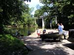
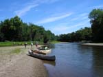
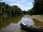
This beautiful Sunday 7 of us paddled in 2 tandem canoes, 2 solo canoes, and 1 kayak. At the put-in we encountered boaters who were coming in from a full night of fishing. Another family put in just before us in 2 boats, plus we encountered 2 other kayakers during our trip. We put in at the Azalia Public Access Site and paddled 15.8 miles to the Bell Ford Public Access Site at Seymour. (Read more about the access sites at the end of this trip report.)
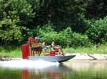
Some of our friends had paddled the section just upstream (from Columbus to Azalia) the day before and had encountered an air boat. They heard it long before they saw it, and they said it sounded like a plane coming to land in the river. So, they recognized the sound when we heard it again that day. The air boat came screaming around the corner and shot up a small "channel" on the other side of the sand bar in the river bend. I call it a channel that the air boat went through, but it didn't even have enough depth to support a canoe or kayak - amazing!
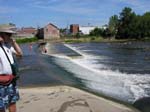
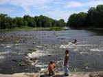
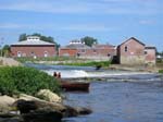
Just downstream of the CR 725 N/Redington St. bridge, on the left bank, is the boat ramp of the Rockford Public Access Site. If you take out here then you cut out 3.4 miles and a dam portage. Just downstream of the Rockford Public Access Site is a dam that requires you to portage on the right. One of our fellow paddlers, an expert canoeist, did run the dam without event, but it is definitely not recommended because it is very dangerous at any water level. The rest of us happily portaged over an exposed portion of the dam. The dam was a very popular spot, with people of all ages swimming, fishing, sunbathing, and otherwise enjoying the water.
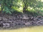
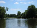
There were some places that were tree-lined and more natural on both sides of the river, but often one side had cut banks falling into the river, or the banks were filled with concrete slabs, rip-rap, or old cars (an attempt to stabilize the river bank). On the opposite side of these cut banks, inevitably, were nice large gravel bars that are perfect for camping (and snack breaks) at these lower water levels.
The water level was about 470 cfs (or about 3.1 feet) according to the Seymour gauging station. The Columbus gauging station showed the river at about 320 cfs (or about 0.53 feet). We were able to paddle the entire day without having to get out and pull our boats. We also saw people with motor boats on the river, if that gives any indication of water level.
The Azalia PAS is located on CR 800 S. Access CR 800 S from SR 11 to the west or from US 31 to the east. The access site is on the south side of the bridge, on the east side of the river. From the river the access site is downstream of the CR 800 S bridge on the left bank.
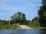
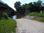
The Rockford PAS is located west of Rockford, off CR 760 E, just south of CR 725 N/Redington St. It is on the east side of the river. From the river the access site is downstream of the CR 725 E/Redington St. bridge on the left bank.
The Bell Ford PAS is located on SR 258, a few miles west of Seymour. It is on the north side of the road and the east side of the river. From the river, the access site is upstream of the SR 258 bridge on the left bank. It is just past the pilings from an old covered bridge that fell in the river several years ago.
Back to White River Trip Reports page | Back to main Trip Reports page
|
||||||||||||||||||||||||||||||||||
 |
||||||||||||||||||||||||||||||||||