Maps to Kankakee River

Below you see a clickable map showing the various Public Access Points (P.A.P.s)  The exact locations of the public access points were painstakingly recreated by cross-referencing the verbal description to the P.A.P. with the less than ideal map provided by Indiana D.N.R.  It is a vital map because it shows you the locations of any dams that may exist along the river.

Remember that these rivers are different than the commercially run rivers.  There isn't a crew to scout and remove any snags that may exist.  Be sure to scout any potential danger areas.  DO NOT TAKE CHANCES!  NEVER canoe any river at or above flood stage. 

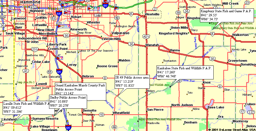
The maps on this site are best when used in conjunction with DeLorme's Indiana Atlas & Gazetteer, which offers topographic maps of the entire state. We always have one in our car.

As an Amazon Associate we earn from qualifying purchases. So, you will help fund this site if you purchase one of these books (or anything else) by clicking the link to Amazon's web site at the right.

click to buy the Indiana Atlas & Gazetteer


Clickable Image Map
(Please report any errors in the maps by clicking here.)

Lasalle State Fish & Wildlife P.A.P. Grand Kankakee Marsh County Park P.A.P. CR 49 P.A.P. Kankakee State Fish & Wildlife P.A.P. Kingsbury State Fish & Wildlife P.A.P. Shelby P.A.P.

 
Outdoor Resources:
Other Information:
 
www.IndianaOutfitters.com - Indiana's Online Outdoor Recreation Guide